Abstract
In 2014, I participated in a multidisciplinary field school course at the Black Friary in Trim, Co. Meath, Ireland. Excavations, with a focus on community driven archaeology, have been conducted at this 13th century Dominican friary for the past five years, under the direction of Finola O' Carroll and Dr. Denis Shine. The project is run by the Irish Archaeology Field School (IAFS), which offers courses in both archaeology and bioarchaeology. These are taught by staff specializing in, amongst other things, medieval masonry, paleopathology, architecture, trauma and community archaeology. Students of all skill levels and educational backgrounds are welcomed and get to experience Irish archaeology through onsite teachings and lectures, as well as by touring archaeological sites throughout Ireland. In this paper I outline the history of the Black Friary and the excavations taking place on the site, while reflecting on how my participation in IAFS' 2014 season helped broaden my archaeological skill set and inform my current postgraduate studies.
Introduction:
Why Ireland? Why Meath?
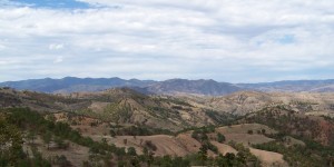
Ireland is a must visit destination for anyone with even a passing interest in heritage. While the country is small (approximately 84,000 km2), its low population density has contributed to the preservation of numerous upstanding archaeological sites, dating from the Irish Mesolithic (Middle Stone Age) (c. 9,000 ybp) through to the modern era. Though beautiful monuments survive throughout the country, County Meath is frequently considered to be the heritage capital of Ireland due to the density and importance of its upstanding archaeological remains.
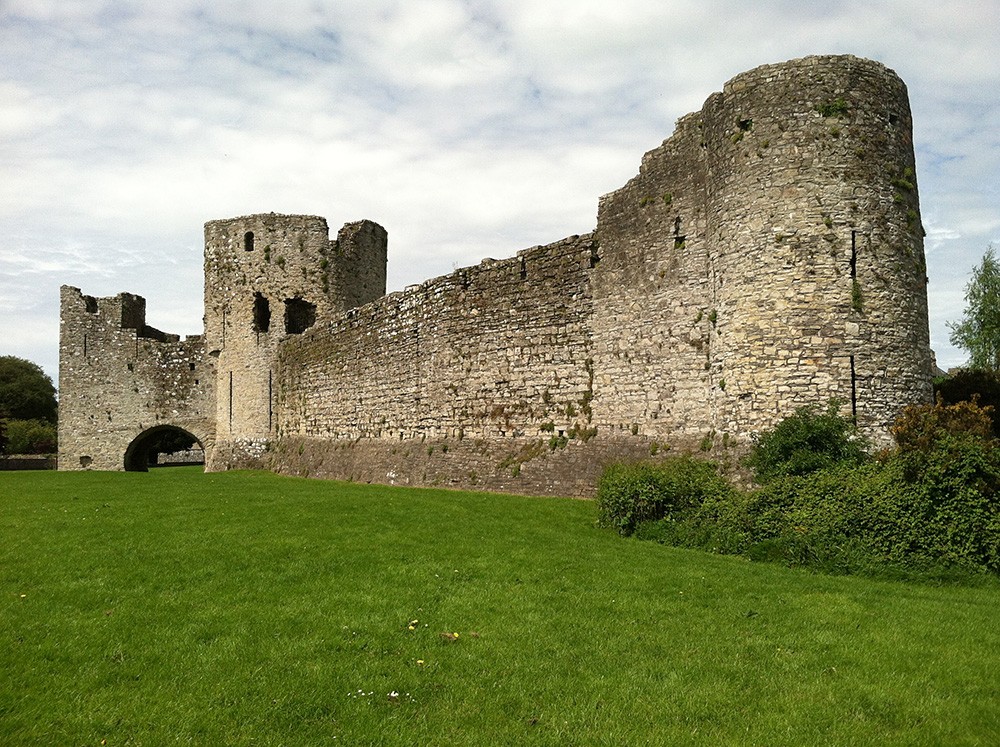
Meath, situated less than a thirty minute drive from Dublin International Airport, is home to beautiful heritage towns and a stunning rural archaeological landscape. Nestled within this rural landscape is the Boyne Valley, a river valley housing world-renowned archaeological and heritage sites such as the UNESCO World Heritage Site of Brú na Bóinne (Newgrange, Knowth and Dowth) and the Hill of Tara. At the western limit of the Boyne Valley lies the medieval town of Trim, a town named from the Irish "Ath Truim," meaning "the ford of the elder tree" (Herity 2001). Trim was established by Hugh de Lacy during the 12th century Anglo-Norman conquests. Subsequently, the town developed into one of the primary medieval centers in Ireland, partly due to its strategic location on the River Boyne. While archaeological evidence indicates the presence of a monastic site within the town from the 6th century (Kieran 2009; Potterton 2005; Potterton and Seaver 2009), Trim is best known today for its high medieval landscape (c. 12th century on) (Potterton 2005, 2009). The town still contains an intact medieval street layout and is home to the largest conserved Anglo-Norman castle in Ireland, Trim Castle. Within modern Trim, just outside the original medieval town limits, is the Black Friary, a 13th century Dominican friary that is home to the current IAFS excavations.
The Black Friary
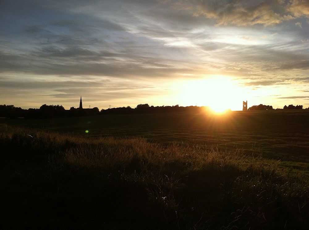
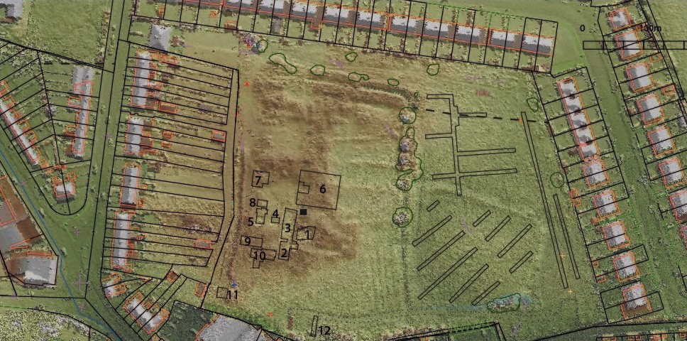
The Black Friary, named for the black robes preferred by the Dominican order, overlooks the River Boyne and is located approximately 200m northeast of St. Patrick's Cathedral (the probable location of the early monastic site of Trim). The friary is situated within a field approximately six acres in area, delineated by modern housing to the north, east, and west, and a supermarket to the southwest. The friary was extensively quarried in the mid-18th century and today is visible on the surface only as a series of grassy hummocks. A bank and ditch runs north-south through the center of the site, dividing the friary precinct (to the west) from friary fields or orchards (to the east). Although the topsoil contains remnants of illegal rubbish dumping, the archaeology has suffered from little disturbance since the 18th century quarrying.
The Black Friary was founded in 1263 by Geoffrey de Geneville and is one of several Dominican houses founded in Ireland after the order arrived in 1224 (Flynn 1993; Ó Clabaigh 2012). De Geneville, a French nobleman serving Henry III, was Lord of Trim during the 13th century — after gaining his title by marrying Matilda, a granddaughter of Walter de Lacy (Potterton 2005). As the Lord of Trim, de Geneville controlled an area known as the 'Liberty of Trim'. After the death of Matilda, de Geneville lived at the friary and was interred there after his death in 1314 (Potterton 2005; Potterton and Seaver 2009).
The Black Friary, thought to be dedicated to Saint Mary of the Assumption, was of considerable importance during the medieval period (Hennessey 2004). It served as the location of an assembly of Irish bishops in 1291, as well as Parliamentary meetings in 1446 and 1491 (Hennessey 2004). After its suppression in 1540, the friary was re-established for a brief period in 1630, only for the friars to be transferred to Donore prior to 1713 (Hennessey 2004). During the 18th century the ruined buildings of the Black Friary were demolished for their limestone (Conwell 1878). Consequently, by the time the Ordnance Survey was conducted in the mid-19th century, only scattered pieces of displaced masonry, such as portions of the bell tower and one of the friary wells, were visible above ground. Despite the destruction of the friary, the site continued to hold significance within the community as a burial ground, particularly for unbaptised children.
Excavations at the Black Friary
Since 2010, archaeological excavations have clarified the outline of the friary buildings and helped elucidate their construction methodology. Excavations have also investigated the burial customs at the site and started to examine agricultural practices in the lands surrounding the friary precinct.
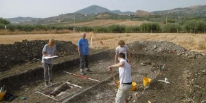
Many of the structures to the south of the friary, including the church, the belfry tower and sections of the cloister garth have been excavated since 2010. Excavations to date have also exposed the limits of the northern and western ranges of buildings, located in Cutting 7 (Fig. 3). Most recently, during the 2014 excavations, a substantive excavation was undertaken within the eastern range of buildings located in Cutting 6 (Fig. 3). This cutting exposed more of the cloister garth, a section of ambulatory and masonry from the eastern range, including a set of stone steps.
Most of my excavation experience took place in Cutting 6, where I was paired with a supervisor who had very different research interests to my own (his being medieval masonry and mine being biological anthropology). Such a pairing provided an opportunity to learn new archaeological skill sets and, while I arrived on site with no knowledge of masonry and architecture, I soon acquired the skills to excavate and record masonry and architectural detail. During my time on site, archaeological test trenching was also conducted to the east of the precinct boundary, providing the first evidence of a medieval field system, as well as a probable medieval enclosure (which may have contained an orchard or livestock).
Numerous artifact types have been recovered throughout the five seasons of excavation, including pottery, building materials, coins, and metal artefacts. Common finds in the 2014 season, when I was onsite, included medieval potsherds (most of which were found in Cutting 6), post-medieval potsherds, and building materials (i.e. stained glass, nails, floor tiles, and stone architectural fragments). A large amount of human and non-human skeletal material was also found, most frequently within the church.
Bioarchaeology
As of the end of the 2014 excavation season, 93 individual burials have been excavated. Burial excavations are conducted under the supervision of Dr. Rachel Scott, Associate Professor of Anthropology at DePaul University, and the IAFS site directors. Prior to IAFS excavations at the Black Friary, a series of burials were excavated from the laneway located along the western boundary of the site (Seaver et al. 2009; Mandal and O'Carroll 2011). Based on current archaeological knowledge, the boundaries of the cemetery are thought to be delimited by the modern 'Kells Road' (which is part of the town's medieval road network) at their western extent. The eastern extent of burials is not yet understood. However, the absence of human remains during archeological testing east of the precinct appears to confirm that burials did not extend past the precinct boundary in this direction (Shine per. comms. 20 November 2014). It has not yet been determined exactly how near burials came to this boundary. Burials, recovered as of 2014, date from the medieval period until well after the mid-16th century dissolution of Irish monasteries. The high prevalence of sub adult remains (n=27/66 as of the 2013 excavation season) could likely be attributed to the site's religious significance post destruction (c. mid-18th century). In this period, the site is thought to have been used as a burial ground for individuals who may not have been permitted burial in consecrated ground elsewhere, such as unbaptised children and infants (O'Carroll 2014).
To date, burials pre dating the dissolution have been found in the cemetery, to the south of the church, as well as in the church itself, the cloister garth and the ambulatory. Burial in these discreet locations would have been decided based on a person's standing; i.e. if they were a member of the Dominican community or a member of the laity with sufficient social standing and wealth to afford burial within the nave of the church (Lagan 2013; O'Carroll 2014).
While complete biological profiles are not yet prepared for each individual, preliminary skeletal indicators of pathological conditions are regularly noted and discussed with students throughout the bone washing process. In my time washing burials, I noted skeletal markers for osteoarthritis and common dental pathologies such as antemortem tooth loss (ATL) and dental caries, as well as evidence for trauma. Bone washing allowed me the opportunity to use training from my previous paleopathology coursework, and was a great addition to the two-week bioarchaeology course I completed in Cutting 10 (Fig. 3), where I helped locate and lift a burial after a pedal phalanx was initially recovered during excavation.
Community Driven Archaeology
In addition to archaeology and bioarchaeology courses, students are also frequently expected to contribute to IAFS' programme(s) of community outreach. IAFS hosts numerous community events each season, including onsite family days, walking tours, school visits, exhibitions, and community lectures. As the field school has expanded, community investment in the Black Friary has also grown, resulting in considerable improvements to the site itself, such as the installation of a community garden inspired by medieval horticulture. More recently, a programme of landscaping works have been developed by IAFS and Meath County Council (the local governing authority), which will be executed by local people to further improve the Black Friary as a community resource in coming seasons. This community aspect of the Black Friary is one that made the dig so enjoyable. Throughout my time on site camaraderie was developed between students, staff, volunteers and community members (all of whom are able to participate in the excavations), leading to an open learning environment that extends beyond just archeological training.
A personal reflection
In total, I attended two sessions with IAFS during their 2014 excavation season. Although my first session lasted only two weeks (their minimum short course), I was instructed in several of the broad suite of techniques used on an archaeological excavation. My second session was significantly longer, lasting approximately eight weeks. Participating in a longer session allowed for a more in depth experience of both excavation and post-excavation strategies. As an American student preparing for a course at an English institution these sessions, being taught predominantly by Irish archaeologists, provided much better preparation for my studies in England than I could have experienced at an American field school.
During my sessions I worked in three different archaeological cuttings (Cuttings 5, 6 and 10) — each with their particular challenges — and conducted post-excavation activities in IAFS' off-site facilities. IAFS expects students (especially those on a long stay) to contribute to all facets of the project, rather than limiting themselves to a particular task or 'area of interest'. Such an ethos means expanding your skill set and professional experience. Thus I was taken out of my niche of bioarchaeology, spending as much time planning masonry and excavating structural remains as I did excavating/processing burials, whilst working alongside both expert archaeological staff and local community volunteers with varying levels of archaeological experience.
I think this unique mix of people and archaeology is what made me want to return for my second session so soon after the first, and is what is currently driving me to use the Black Friary as a case study for my postgraduate dissertation. I will be returning to the site in 2015 to conduct research as part of my MSc. As part of this research, I aim to use ground-penetrating radar (GPR) to identify sub-surface features (especially individual graves) that have not been recognised during previous surveys (see for example Kennedy 1989). Results from this method of survey could have significant implications for designing future excavation strategies at the Black Friary in detecting mass graves within Europe.
Acknowledgements
I would like to thank Dr. Denis Shine for his help in the editing of this work and for providing one of the above images. I would also like to thank the rest of the IAFS staff, especially my cutting supervisors for their help and the wonderful experience and skills I gained through attending the field school.
Bibliography
- Conwell, E. (1878). A Ramble around Trim amongst its Ruins and Antiquities and Short Notices of its Celebrated Characters from the Earliest Period. Dublin: Gill and Son.
- Flynn, T. (1993). The Irish Dominicans, 1536–1641. Dublin: Four Courts Press.
- Hennessy, M. (2004). Trim; Irish Historic Towns Atlas, No. 14. Dublin: Royal Irish Academy.
- Herity, M. (Ed) (2001). Ordnance Survey Letters Meath: Letters containing information relative to the antiquities of the county of Meath collected during the progress of the Ordnance survey in 1836. Dublin: Four Masters Press.
- Kennedy, W. (1989). An Archaeological Survey of the Blackfriary Site, Trim, Ireland. Report to the Office of Public Works, Florida Atlantic University.
- Kieran, E. (2009). Burials at St Patrick's Cathedral: New Evidence for the Early Medieval Ecclesiastical Site at Trim. In M. Potterton and * M. Seaver (Eds). Uncovering Medieval Trim. Dublin : Four Courts Press.
- Lagan, E. (2013). The Dead Beneath the Floors: The use of space for burial in the Dominican Black Friary in Trim, Ireland. [Online]. Available at: Irish Archaeological Research, 5.
- Mandal, S. and O' Carroll, F. (2011). A New Model for Site Preservation and Archaeological Practice. [Online]. Available at: http://www.archaeological.org/sites/default/files/files/Mandal%20and%20O'Carrol%20v_3.pdf
- O'Carroll, F. (2014). Archaeological Excavations at the Black Friary. [Online]. Available at: http://iafs.ie/wp-content/uploads/2014/06/Black Friary-E4127-C240-Report-2014.pdf
- Ó Clabaigh, C. (2012). The Friars in Ireland 1224–1540. Dublin : Four Courts Press.
- Potterton, M. (2005). Medieval Trim, History and Archaeology). Dublin : Four Courts Press.
- Potterton, M. (2009). Trim in the Middle Ages: A Market Town on the River Boyne. Archaeology Ireland, Heritage Guide, No. 47. Bray: Wordwell.
- Potterton, M. and Seaver M. (Eds) (2009). Uncovering Medieval Trim. Dublin : Four Courts Press.
- Seaver, M. Kelly, M. and Travers, C. (2009). Burials at the Well: Excavations at the Black Friary, Trim. In M. Potterton and M. Seaver (Eds). Uncovering Medieval Trim. Dublin : Four Courts Press.