North Duffield is an agricultural village in the south of the Vale of York and on the edge of the Lower Derwent Valley. It is 6 miles from Selby and 12 miles from York.
The village name derives from an Anglian settlement of the 10th century according to the British Placenames Society and is mentioned in the Domesday Book as having a castle. It is my belief that the castle was built to protect the ferry crossing of the River Derwent much as Malton Castle does. The ferry is mentioned as early as 12th century and it is likely to have existed before that. The Derwent is the County boundary between North and East Yorkshire, although, North Duffield has been in the East Riding for most of its existence prior to the boundary changes of 1974.
More recently, much documentary research has been conducted by members of the Society and, following requests for people to scour their lofts and cupboards, the Society has come into possession of a huge amount of previously unseen photographs and documents.
We now have an expanding archive that is proving something of a headache in terms of storage and indexing. Nevertheless, with the huge advances in our knowledge we set about the task of writing a new, more complete and, dare I say it, more professional village history.
The Society had not hitherto ventured outside the field of documentary research until a set of happy coincidences conspired to broaden our horizons.
Due to my involvement with another local group I found that I was able to access archaeologically based training courses to feed my long-held passion for archaeology and, in particular, a free course run by Dr Jon Kenny of York Archaeological Trust at Hungate. I became a volunteer at Hungate and began organising archaeology based events such as aerial photography interpretation with Yvonne Boutwood of English Heritage in York.
I had previously obtained crop-mark maps from North Yorkshire County Archaeologist, Linda Smith, mainly for the Skipwith area, but also, as an after thought for North Duffield too. When they arrived, I was astonished to find a complex of crop-marks including Iron Age hut circles, north of the village and a further complex to the west. To the best of my knowledge this was the first inkling anyone in the village had of a history stretching back to before 900AD.
About this time I left the Skipwith group to concentrate on North Duffield and Dr Jon Kenny saw this as an opportunity to proposition me and ultimately the Society, with a task that was to prove both exciting and important both for the village and, perhaps the greater archaeological community.
Questions about the visibility of crop marks in certain conditions, seasons, weather conditions and soil types have been raised from time to time and some work has been done, particularly in North Lincolnshire. Dr Mark Whyman of York Archaeological Trust made a presentation to the Society in which he raised the question of why crop marks appear predominantly on the sands and gravels and rarely on the clays and silts and alluvium of the '25 foot drift'. The drift was laid down at the end of the last Ice Age some 12,000 years ago and covers the Vale of York. Was it that there were features there but that they did not show up on the latter two soil-types or, indeed, were there no features to show up.
And so the final happy coincidence is that North Duffield can boast all three soil-types, all in close proximity to each other and all in a relatively close proximity to known crop marks on the sands and gravels.
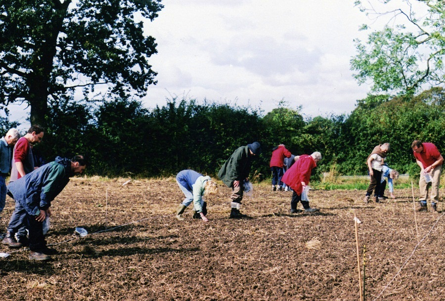
So we set about a programme of fieldwork. Permission to walk many of the local fields on the sands and gravels and clays and silts was obtained from most, but not all farmers. Notably, two flatly refused us access to their land. The alluvium poses more of a problem. Firstly it is an SSSI and a National Nature Reserve and, being a flood-plain is under pasture and therefore field- walking is out of the question. Interestingly, the very fact that it is a flood- plain, means that over the millennia, a considerable thickness of silt has been deposited which both protects and conceals Palaeolithic and later landscapes. Research in other lowland areas has revealed that early humans frequented these areas presumably living in temporary camps since no caves were available for them.
We also commenced a programme of Resistivity surveys, initially of the village green to investigate a strange hump in an essentially flat landscape. The results have indicated a number of anomalies that will be investigated by test excavation.
The field-walking has resulted in Roman and Medieval pottery sherds being recovered confirming the presence of the Romans in North Duffield although formal identification of the 'finds' has yet to take place.
We have recovered many items of interest to the village without them having much archaeological significance. We have currently walked two and a half fields, one of mainly sands and gravels and the rest of clays and silts. None of these fields show any crop-marks other than ridge-and-furrow, now ploughed out.
We are currently formulating a Heritage Lottery Bid to carry the project forward. Funds to allow the employment of professionals for advice and support, to purchase equipment and to run three events, one in each of the next three years,
The first involves a 1m test pit in gardens in the village and many local people have already committed to this. It will give us a snapshot of the village and we hope add to our knowledge of the archaeology. The second event will be a re-enactment of Iron Age and perhaps Roman life and will also involve the building of an Iron Age round-house from locally sourced materials.
The third event will conclude the three year plan and involve a weekend of events, lectures and presentations by both the Society and professional experts on the work we have done, the conclusions we have reached and the success or otherwise of the project.
During the course of the field-work we have utilised North Duffield Community Primary School staff and pupils whose, knowledge, enthusiasm and commitment has been outstanding. Not only have they walked the fields but they have washed the 'finds' they have uncovered. Dr Jon Kenny of York Archaeological Trust has been involved with the school from the start and his visits always result in lively participation by children and staff. Indeed, the new Head Teacher is keen to become involved on a personal level with his own family.
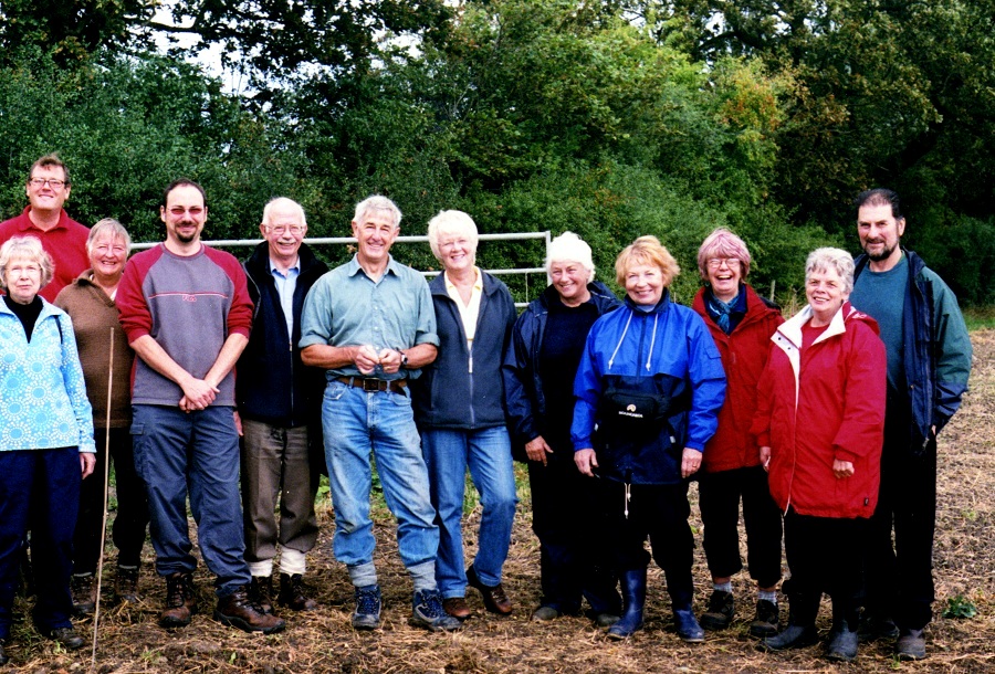
We have a good body of volunteers of all ages from 6 years of age to senior citizens and include amongst our number, retired archaeologists, trainee archaeologists and others bringing a range of skills from their life and employment.
Archaeology and the thirst for knowledge is thriving in North Duffield. The Parish Council is on board and hungry for information and so are local landowners. Attempts to involve local disability groups have so far proven unfruitful although I have high hopes that we can involve some of them and thereby increase their self-esteem and self-worth.
We successfully applied for a small grant from a local funder which allowed us to purchase tape measures and we have access to surveying equipment from YAT and other local groups. We have conducted training sessions for people from other local history and archaeology groups and York University has sent students to assist with field-work. We offer the opportunity to anyone to come along and gain experience in field-work and some local societies have sent representatives from time to time.
Anyone wishing to get involved is invited to contact me on 01757 288939, 07971 220737 or ndchs [at] talktalk.net.