Our excavation at Boltby Scar began on May 3rd 2011. This was the first archaeological excavation I had ever visited, let alone been a part of, and from day one I was hooked. Boltby Scar has a complex history, which is one reason for its appeal. We must examine not one, but two excavations: the first was undertaken by G.F. Willmot, the notable Yorkshire antiquarian, in 1938 (Powlesland 2011a); the second, and most recent, was led by Professor Dominic Powlesland of the landscape research centre, aided by myself and around thirty other first year archaeologists. In 1961 much of the site was bulldozed in order to create more agricultural space. These events have vital roles to play in the story of this Late Bronze Age/Early Iron Age hill fort and associated barrows that sit overlooking the Vale of Mowberry in the Yorkshire Moors.
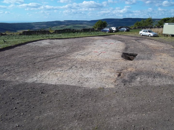
First some context: Boltby Scar sits in a region rich with Bronze and Iron Age activity, such as the hill fort at Roulston Scar, the largest Iron Age fort of its kind in northern England, and the hill fort of Live Moor, also on the North Yorkshire Moors. Dykes such as Cockmoor Dyke and Cleave Dyke also provide a modern day reminder of the huge amount of activity occurring up on the Moors at this time. The hill fort at Boltby Scar fits nicely into this landscape as another monument to the human agency that went into the construction of this prehistoric region. The site at Boltby has been known since the 18th century (Powlesland, 2011a), and ever since has been under the close attention of antiquarians and in more recent years archaeologists alike. As early as 1868 the site was appearing in the writings of antiquarians (Powlesland, 2011a) but it was not until the excavation performed by Willmot in 1938 that any detailed records of the site were produced.
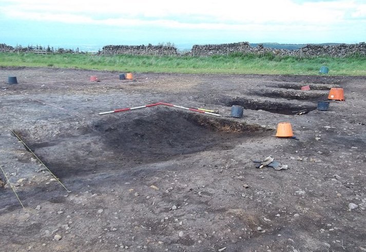
The main areas of focus for the 2011 excavation were threefold. Firstly, the entrance area identified by geophysical survey, thought to be the defences and supposed location of the Middle Bronze Age barrow. Secondly, the interior of the enclosure was to be examined in order to search for evidence of other settlement buildings. Finally, the larger still intact barrow was to be excavated for environmental and dating material (Powlesland, 2011a). The excavation groups were likewise split into three, with groups L and M working in the larger trench, AD, aimed at understanding the first barrow, the hill forts defences and the interior, and group K examining the second, still upstanding barrow.
It is safe to suggest that all three of the training excavations in 2011 and those of previous years began in the same way: troweling back. This oldest and noblest of archaeological traditions was possibly not one that some of those onsite considered to be the most enjoyable aspect of archaeology, and yet the excitement around the site following the first day of troweling when the structure of the hill fort was seen was palpable. The rampart and ditch, along with the entrance way became clear from day one and the significant size of these defences demonstrated the impressive nature of the site. The geophysical survey showed only one entrance way through the defences at Boltby, however it is possible that there was another on the southern, unexcavated side that did not show up on the survey (Powlesland, 2011a). Upon excavation of the section of the rampart that had escaped the charms of the bulldozer in the 1960s, we were all treated to Dominic Powlesland's extreme excitement in seeing such 'sexy stratigraphy' that proved the use of turf to face the rampart (Powlesland, 2011a).
A large part of the excavation was of the surrounding ditch to different levels. Thanks to environmental sampling, the layers of peat built up in the ditch allowed us to create a time frame for how the ditch began to fill up. However, we are currently still waiting for environmental results to be finalised to gain an accurate picture. The aim of excavating the ditch to its fullest extent, however, kept a number of excavators busy for nigh on the full four weeks, with heads gradually disappearing below the top of the trench. The results showed a depth of 1.5m, a significant size possibly suggesting this was more than simple enclosure and strengthening the evidence for a hill fort.
The excavation that we performed on the interior of the enclosure uncovered neither evidence of buildings, nor any significant evidence. Other than the first week when groups L and M had the questionable pleasure of excavating the significant bulldozer tracks, further excavation of the interior of the hill fort was limited to the excavation of some possible robber pits that may have been used to form the rampart. The most common find, and for the first two weeks the only finds were worked flints, which caused great excitement and competition amongst us undergrads, with each student keeping their own running tally and the most successful students trying (and mostly failing) to hide their glee. The few shards of pottery found just inside the entranceway to the enclosure gave us a date of c.800-900BC for its use. There could of course be further evidence for occupation in unexcavated areas, however current evidence suggests this could have simply been used as a temporary stopping point when moving across the landscape.
The first barrow, located just inside the rampart and ditch and flattened by the bulldozer to make more agricultural land, was the focus of much of Wilmot's attentions. Some of the results of his excavations survive in sketch plans, but the most noticeable survival is that of the two early Bronze Age gold hair loops that he discovered at the base of the barrow. These are thought to be associated with a cremation which the 2011 excavation failed to identify beyond a small number of irretrievable bone fragments, despite the best efforts of those involved and the inevitable disappointment that Wilmot had got there first.
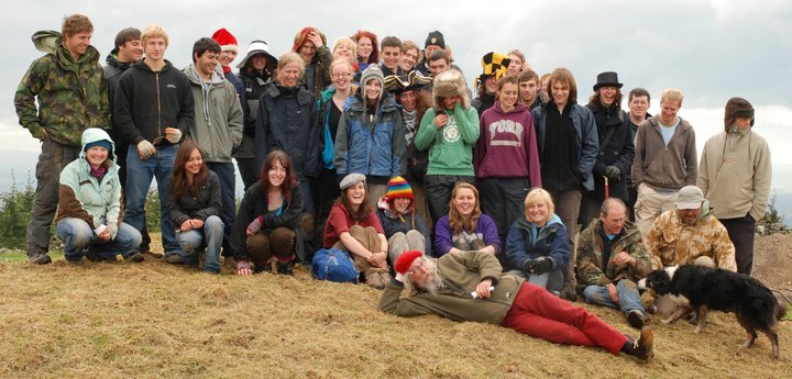
Group K were located a little way out from the main trench AD where L and M were working, and had the task of understanding the second, more intact barrow. Evidence from their excavation suggests that the barrow was put up in six stages, with the second phase being dated, thanks to a charred hazelnut, to around 1920-1730BC. It is suggested that this barrow was used for burial. However, due to the large amounts of robbing that occurred, as well as Wilmot's trench that ran through it, it is hard to gain more useful evidence from the barrow itself. One of the most fascinating aspects of our excavation at Boltby was the continuous revaluation of the site and its possible meaning. The senior team of excavators were instrumental in helping with the understanding of a site, and reinforced of my personal belief that the best interpretations are often made on site with the primary evidence. In each end of day debriefing there was always a new and exciting possibility for us to examine the next day, in a site that could continuously change. Fuelled on tea and cakes from various quarters, and the variety added by various odd hats chosen to be worn by Maximilian O'Keeffe, those of us lucky to excavate at Boltby scar will remember it for a long time to come.
Bibliography
- Powlesland, D. (2011a). Excavations at Boltby Scar, An interim report. The landscape research centre. October 2011. Available at http://www.landscaperesearchcentre.org/Boltby_Scar_2011_Interim.pdf (Accessed 28/1/2012).
- Bagley-Sweet, D., Burnell, C., Chipping, E., Colbourne, L., Cole, J., Deller, S., Devereux-West, K., Fellows-Yates, J.,Foster, J., Gascoigne,K., Henser-Brownhill, T., Jones, B., Kemp, E., Lambert, K., Lodge, N., Margetts, T., Martin-Geary, A., Murphy, K., Nino de Guzman, A., O'Keeffe, M., Neale, R., Padden, H., Rawlinson, K., Rolandsen, G., Rooney, L., Tomlinson, N., Whittaker, M., Whittaker R., (2011). Boltby Scar Exploration Blog, May 2011. Available at http://boltbyscar.wordpress.com/ (Accessed 28/1/2012).
Further research
- Powlesland, D. (2011b). A 3D Model of the Hillfort created using unconstrained air photography in the Landscape Research Centre Blog, http://www.thelrc.wordpress.com (Accessed 28/1/2012).